LOGO

San Diego County
A Bicyclist's Paradise

HOME
RIDES
ROUTES
CLUBS
TRANSIT
ORGS
BUSINESS

Photograph
Bicyclists pause at scenic La Jolla Cove at 11:55 AM on November 30, 2005.

Please e-mail comments, corrections and additions to the webmaster at pje@efgh.com.

Mild weather all year round.
Varied terrain, from flat to mountainous.
Bike lanes on most of the newer highways, and on many of the older ones.
Annual bike-to-work day.
Major organized bike rides.
Bicycle-friendly mass transit.
Local bicycle clubs.
Local bicycle education and advocacy organizations.
Bicycle velodrome in Balboa Park.
Bicycle shops and other bicycle businesses.
Separated bike paths.

For general information about the San Diego area, you may want to check the following websites:

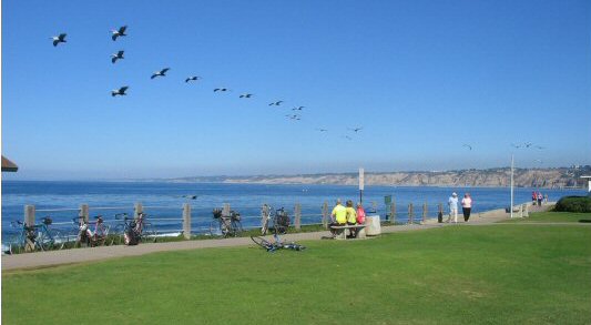
The photograph above makes a good desktop background for your computer screen, especially in its original form with more green and blue space. You can download the appropriate size:

If your screen size is not included, download the original and use some photo editing software to make an image of the correct size by cropping it and/or shrinking it, or ask the webmaster for a particular size. If you set the wrong size as a desktop background, the image quality may suffer when the operating system resizes it.


Bicycle News and Notes

Tuesday night bicycle racing at the San Diego Velodrome begins on April 1.

The northern portion of the Sorrento Valley Road Bike Path has finally been paved.

The South Bay Expressway (the southern extension of Highway 125) has been opened. Starting next spring, bicyclists will be able to ride across the Otay River Valley on the new bridge, which will be 3000 feet long and 150 feet high. For more information see www.southbayexpressway.com.

The 2007 San Diego Region Bike Map is finally available online. Go to www.ridelink.org and navigate to "Commuter Services" and "Biking". You can also order a printed copy, which is now available. Printed copies may also be available at some bike shops and other locations.

Construction has disrupted parts of the San Luis Rey River Path in downtown Oceanside. The short segment connecting the path with Pacific St. is closed.

Funding is finally available for the Lake Hodges Bicycle and Pedestrian Bridge. The bridge will be opening as soon as they can get it built.

The I-15 Freeway has been closed to bicycles between Centre City Parkway and Via Rancho Parkway. A signed detour is inferior to the one most cyclists have been using for years. See Bicycling through South Escondido.

The East Ted Williams Bike Path is closed during construction on the interchange between California Highway 56 and Interstate Highway 15. It will remain closed until the construction is complete.

Construction on an interchange between California State Highways 125 and 54 has effectively blocked direct bicycle travel between Bonita and La Presa. The nearest alternate route that remains open to bicyclists is via Briarwood Road and Paradise Valley Road. The good news: When the interchange is completed and the dust has settled, Quarry Road will be reopened as a bicycle and pedestrian path.

The East Escondido Creek Bike Path is closed at and near Ash St.

Scanned topographic maps for San Diego, Orange, Imperial, Riverside and San Bernardino Counties are available online at www.efghmaps.com. These are public domain images in GIF format with no restrictions on use.


About the Webmaster

This website is brought to you by Philip J. Erdelsky, a resident of San Diego since 1969, and a bicycle rider since about 1974.

Visit my home page at http://www.alumni.caltech.edu/~pje/.

E-mail comments, corrections and additions to me at pje@efgh.com.

Photographs of the webmaster. Click on description to display photograph.


Policies Regarding Privacy and Other Matters